Mayon Volcano Eruption Threat Grounds Flights: 231 Passengers Stranded in Bicol Region
Alert Level 2 declared. Ash plumes at 800 meters. Four routes suspended. Here’s what actually happened, why the call was right, and what it means for travelers and the Bicol economy.
What Phivolcs Recorded — and Why It Triggered Airspace Closure
On the morning the alert was raised, the Philippine Institute of Volcanology and Seismology (Phivolcs) wasn’t reacting to a single dramatic event. They were reading a pattern — and that pattern told a coherent story of escalating unrest.
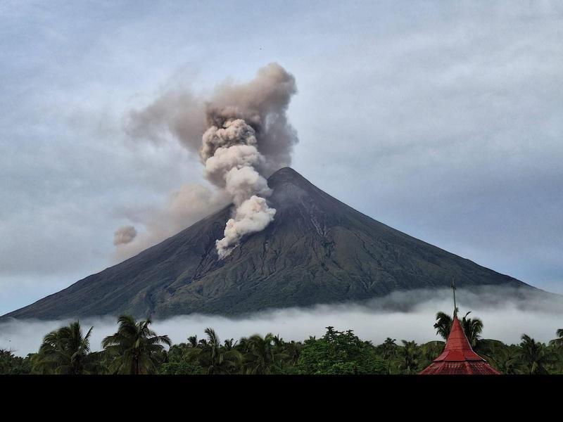
Over the preceding 48 hours, monitoring stations around Mayon registered dozens of volcanic earthquakes, including low-frequency events. That distinction matters. High-frequency earthquakes near a volcano typically indicate rock fracturing under stress. Low-frequency events indicate fluid movement — specifically, magma forcing its way through conduit systems. That signature, combined with a sulfur dioxide (SO₂) flux averaging 1,500 tonnes per day, pointed to a shallow, actively degassing magma body.
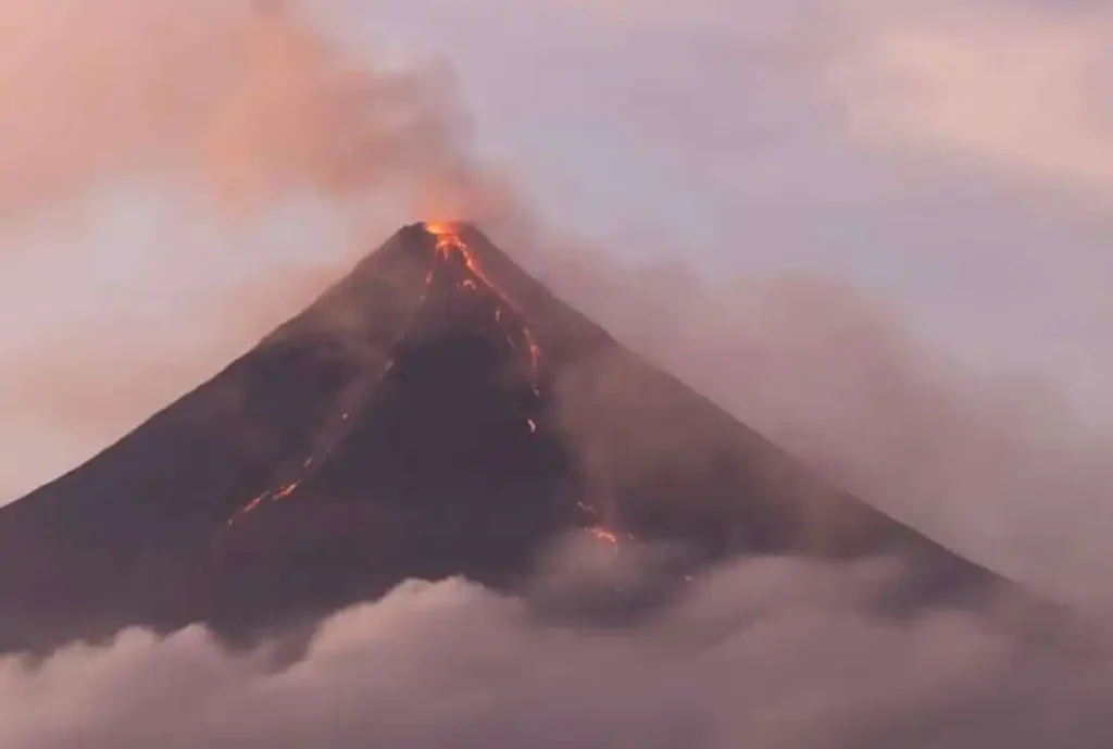
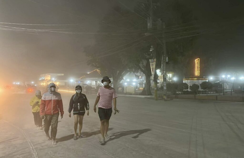
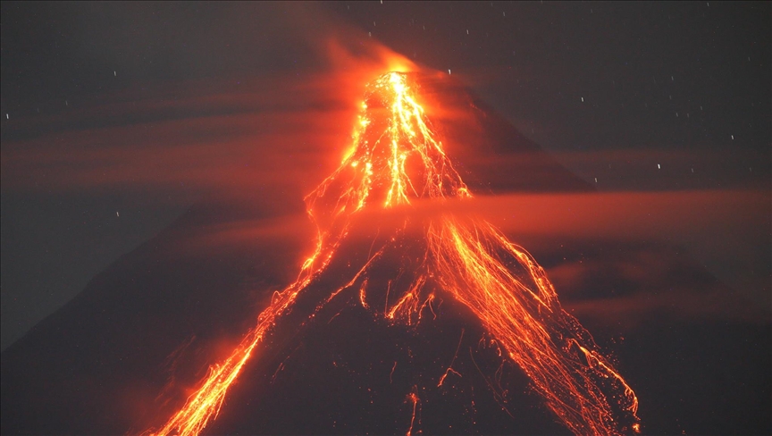
Phivolcs raised Mayon’s alert status from Level 1 (low-level unrest) to Alert Level 2, defined as “increasing unrest” with hazardous eruption possible within weeks to months. Minor ash eruptions followed, producing plumes reaching 800 meters above the crater rim.
That 800-meter figure is where aviation enters the equation.
Ash at altitude doesn’t behave the way most people imagine. It doesn’t settle quickly, and it doesn’t announce itself visually on radar the way weather does. Fine volcanic particulate — silicate glass, mineral fragments, and partially crystallized magma — gets suspended in the atmosphere and dispersed by wind across flight corridors long before pilots or ground radar can detect it. Once ingested into a turbofan engine, it melts at temperatures between 1,100°C and 1,200°C — which is precisely the operating temperature of turbine blades — and resolidifies as a glassy coating on internal components. The result can be catastrophic engine damage or failure.
The Civil Aviation Authority of the Philippines (CAAP) operates under ICAO Document 9691 protocols, which establish ash concentration thresholds and mandatory coordination with Volcanic Ash Advisory Centers. When satellite imagery indicated ash clouds positioning between 10,000 and 20,000 feet — the exact flight levels used during approach and departure from Bicol International Airport in Daraga, Albay — suspension of operations was not discretionary. It was procedurally required.
The Ground Reality: 231 Passengers, Four Routes, Multiple Airlines
Confirmed cancellations affected at least four scheduled commercial flights operated by Cebu Pacific, Philippine Airlines, and AirSWIFT. The passenger impact broke down roughly as follows:
The Manila–Legazpi corridor took the heaviest hit, with approximately 180 passengers stranded across three canceled return-trip flights. The Cebu–Legazpi route accounted for the remaining 51 passengers, across one round-trip cancellation. A small number of charter operations were also suspended as a precautionary measure.
What the headline number doesn’t capture is the secondary disruption. For every stranded passenger, there’s typically a ground operator, a hotel booking, a boatman waiting at Donsol, a tour van idling outside Misibis. The ripple is wider than the immediate count suggests.
Airlines moved quickly on rebooking, offering a combination of alternative routing (via Clark or Cebu as connecting hubs), full refunds under force majeure provisions, and ticket holds for later dates. The Albay local government unit activated Tourist Assistance Desks at major transport terminals and coordination points in Legazpi City to help passengers navigate ground alternatives.
Why This Flight Decision Was Correct — and Why It’s Often Made Too Late Elsewhere
The 1982 eruption of Galunggung in Indonesia — a lesser-known reference than Pinatubo but operationally significant — caused a British Airways 747 to lose all four engines simultaneously after flying through an ash cloud at night, without visual warning. The crew restarted three engines below 12,000 feet and landed safely in Jakarta. That near-catastrophe became the foundational case study for modern volcanic ash aviation protocols.
The Philippines, with 24 active volcanoes and one of the busiest domestic air networks in Southeast Asia, has developed relatively mature protocols by regional standards. But they are not frictionless. Cancellations impose financial costs on carriers, operational costs on airports, and significant inconvenience on passengers. Airlines do not cancel lightly. The fact that Cebu Pacific, PAL, and AirSWIFT all aligned on suspension within hours of the Level 2 declaration indicates the ash distribution pattern was unambiguous enough that no carrier wanted to test the threshold.
The alternative — flying through marginal ash concentration while awaiting better data — carries asymmetric risk. A safe flight through light ash produces no useful information and sets a precedent for future risk tolerance. An engine flame-out on approach to Legazpi over a populated area produces an outcome that cannot be undone.
The call was correct. The system worked as designed.
The Bicol Economy in Suspension
The timing created compounding pressure on a region already running on seasonal tourism revenue.
Bicol’s economic calendar is heavily weighted toward the months when weather is favorable and schools are on break — the same windows when Mayon tends to behave unpredictably. Legazpi City, the regional hub, draws visitors primarily for three experiences: Mayon itself (the near-perfect cone viewed from the ATV trails and viewdecks of Cagsawa), the whale shark interaction in Donsol, and the marine reserves around Ticao Island.
None of those experiences require flying directly into ash. But they all depend on Bicol International Airport functioning.
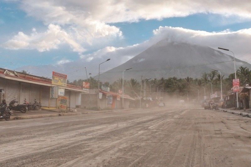
Local accommodation providers reported at least 150 room cancellations or deferrals within the first 24 hours. Ground transport operators — the van fleets and jeepney drivers who shuttle tourists between Legazpi, Donsol, and the viewing areas — reported demand drops of roughly 40 percent. Tour operators handling fixed-price packages absorbed the bulk of that loss without immediate recourse.
Some travelers adapted by routing through alternative airports. Virac in Catanduanes and Naga (Pili Airport) became pressure-relief valves, with passengers adding four to six hours of land travel to reach Legazpi. That workaround works for leisure travelers with schedule flexibility. It does not work for business travelers, medical passengers, or anyone connecting onward internationally.
The Department of Tourism’s Bicol regional office coordinated with airline commercial teams on rapid resumption planning, dependent on Phivolcs bulletin updates. That coordination — between a scientific monitoring agency, a civil aviation regulator, commercial carriers, and regional tourism stakeholders — is where the real operational complexity lives. Volcanic ash management is a multi-agency logistics problem, not just a weather call.
What the Phivolcs Monitoring System Is Actually Tracking
For travelers trying to interpret bulletins in real time, understanding what Phivolcs measures — and what the measurements indicate — helps cut through the noise.
The monitoring network around Mayon includes seismic sensors for earthquake detection and event classification, GPS receivers to measure ground deformation (inflation indicates magma accumulation beneath the surface), gas spectrometers using differential optical absorption spectroscopy (DOAS) to quantify SO₂ flux in tonnes per day, and visual surveillance cameras with infrared capability for nighttime and low-visibility monitoring.
Alert Level 2 does not mean an eruption is imminent in the next hours or days. It means the volcano is in a state where a hazardous eruption is plausible within a weeks-to-months window, and that unrest indicators are trending in the direction of further escalation. Alert Level 3 indicates magma is at or near the surface. Level 4 is imminent hazardous eruption. Level 5 is ongoing hazardous eruption.
The 2018 Mayon eruption — which reached Level 4 and ultimately displaced over 100,000 residents from the permanent danger zone — began with a similar pattern of elevated SO₂ and phreatic explosions. That event is the reference point that shapes how Phivolcs, CAAP, and airline operations centers model their decision thresholds today.
The current unrest, as of this writing, does not replicate the trajectory of 2018. But it does demand the same systematic attention.
Practical Guidance: What Travelers With Bicol Plans Should Do Now
The information environment around volcanic unrest is noisy. Airlines send generic delay notifications. Social media circulates outdated satellite images. Tourism boards issue reassurances that lag behind Phivolcs bulletins. Here is a tighter framework for making real decisions.
Before departure: Read the Phivolcs daily bulletin directly at phivolcs.dost.gov.ph. The bulletin publishes SO₂ flux, seismic event counts, and alert level with more precision than any secondary source. Check whether your booking’s airport is Legazpi (ZLC), Naga (WNP), or Virac (VIC) — each has a different exposure to the flight corridor risk. Confirm your airline’s rebooking policy specifically covers volcanic events, not just weather. These are categorized differently in most fare conditions.
If your flight is canceled: Contact your airline directly before going through a travel agent or OTA — airlines prioritize direct contact for rebooking inventory. If you are physically in Legazpi, the Tourist Assistance Desk at the provincial capitol or the Legazpi City Tourism Office can connect you with verified ground transport and accommodation. The Manila–Legazpi bus corridor via Maharlika Highway (RRCG, Philtranco, Raymond) operates overnight and covers the route in 10 to 12 hours. That is not comfortable, but it is reliable.
Near the volcano: Respect the 6-kilometer Permanent Danger Zone. This is not a suggestion — it is a legally enforced exclusion zone backed by the local government of Albay and enforced by barangay officials and police. Ash fall warrants N95 or equivalent respiratory protection, not a surgical mask. If heavy rainfall occurs during or after eruptive activity, avoid river channels and valley floors regardless of distance from the summit — lahars travel at speeds and distances that routinely catch people off guard.
Looking Forward: When Do Flights Resume?
Resumption depends on three converging conditions: Phivolcs confirming a stable or declining trend in SO₂ flux and seismic activity, the ash cloud dispersing from the active flight corridor (confirmed via satellite composite and pilot reports), and CAAP formally lifting the NOTAM (Notice to Airmen) that suspended operations.
In past unrest events that did not escalate beyond Level 2, that window has typically been 48 to 96 hours. The 2018 eruption extended that window to weeks, with full normal operations not resuming until Alert Level 4 had been lowered in stages.
Airlines will resume as soon as the regulatory clearance exists — the commercial incentive to operate is strong. The constraint is regulatory, not commercial.
Phivolcs publishes bulletin updates twice daily. Those updates are the most reliable single source for estimating when the resumption window opens.
The Systemic Reality of Bicol’s Volcanic Risk
Mayon erupts, on average, every few years. Significant unrest events occur more frequently. This is not an anomaly — it is the baseline operating condition for a region that sits on one of the most volcanically active arcs on the planet.
That reality has shaped Bicol’s infrastructure, emergency management culture, and tourism industry in ways that outsiders underestimate. The LGU of Albay has won international recognition for its disaster risk reduction framework, which predates most of the national systems it eventually influenced. Airlines that operate Legazpi routes price volcanic risk into their operations planning. Hotel operators in Legazpi City carry contingency for demand swings.
The 231 passengers stranded by this cancellation will get home. The flights will resume. The whale sharks will still be in Donsol. The ATV trails around Cagsawa will reopen. Bicol is not closed — it is temporarily constrained by the same geological force that makes it one of the most visually dramatic destinations in the Philippines.
That constraint is temporary. The volcano is permanent.
For real-time updates, monitor the Phivolcs official bulletin and your airline’s advisory channels. Ground transport alternatives remain fully operational throughout the unrest period.